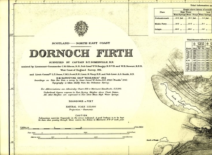
Admiralty Chart of Dornoch Firth 1912
Date Added: 20 November 2008
Year: 1912
Institution Name: dnhhl
Cat No: ◀ | 2008_132 | ▶
Picture No: 6233
Admiralty Chart of Dornoch Firth 1912 with a number 2170 and title and all relevant details, including scales, at top left. The chart illustrates the extensive sand banks and the very narrow passage down the firth. There are several crossing routes shown for the Meikle Ferry. A 'Fring Danger Area' is delineated on the Dornoch Sands. The outline map of Dornoch shows relatively few buildings.
Dimensions: Length950 mm - Width 1010 mm
Comments
Form Goes Here