Map of Littleferry area
Date Added: 24 April 2008
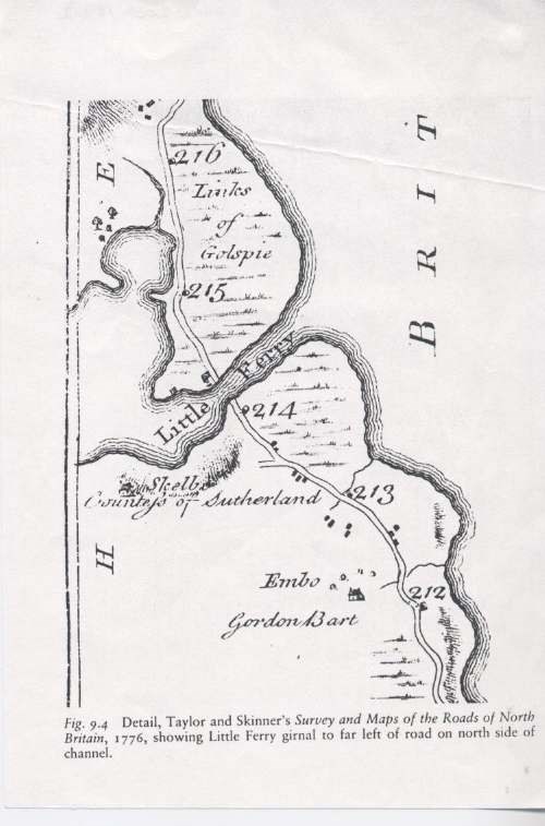
Year: 1776
Institution Name: dnhhl
Cat No: ◀ | 2007_187_02 | ▶
Picture No: 3321
Photocopy of part of the 1776 Taylor and Skinner road map, showing the area from just north of Dornoch up to the Links of Golspie. Shows Embo House and Skelbo.
Dimensions: Width 130 mm - Height 189 mm
Comments
Form Goes Here