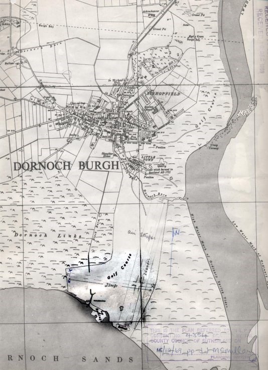
1969 Map of Dornoch Airstrip
Date Added: 11 June 2010
Year: 1969
Institution Name: dnhhl
Cat No: ◀ | 2010_053_08 | ▶
Picture No: 9146
An outline map scale 1:10560 (6 inches to the mile) showing the 1969 proposed siting of Dornoch Airstrip produced by Sutherland County Council. This map shows the siting of the main and subsidiary runways further south and west than the Roads Department plan drawing of 1972 (see 2010.053.07) and the ultimate alignment of the single runway. This map is connected with the Temporary Aerodrome Licence dated 22nd July 1969 (see 2010.053.09)
[The pdf document, which can be accessed using the link below this description, includes a second page with an outline in red of the ultimate alignment of the single east west runway.]
Dimensions: Length 460 mm - Width 337 mm
Comments
Form Goes Here