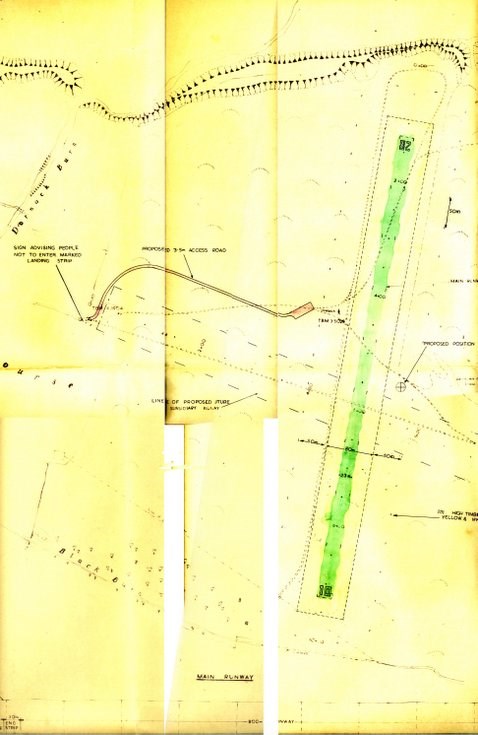
Map of Dornoch Airstrip
Date Added: 11 June 2010
Year: 1972
Institution Name: dnhhl
Cat No: ◀ | 2010_053_07 | ▶
Picture No: 9145
Map showing the proposed siting of Dornoch Airstrip produced by Sutherland Council Roads Department scale 1:2500 dated 1972. The map also shows the line of a proposed subsidiary runway.
(Image shows only that part of the plan showing the runway)
Dimensions: Length 990 mm - Width 677 mm
Comments
Form Goes Here