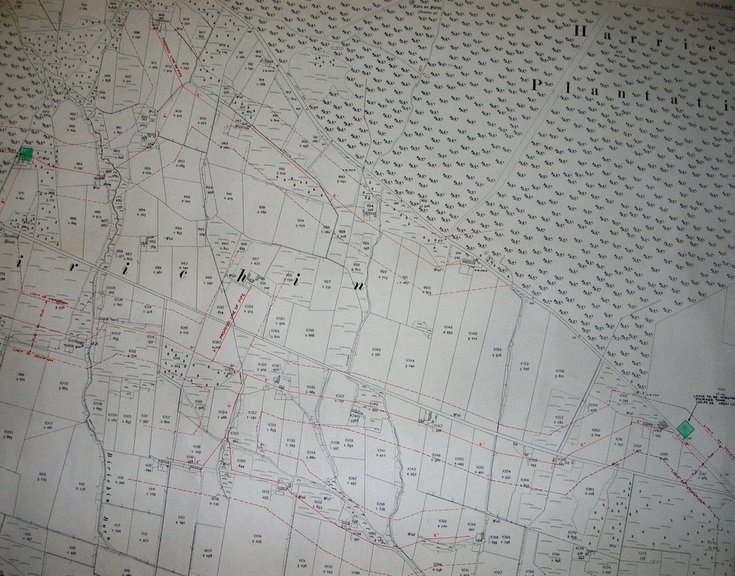
OS Map Second Edition 1906 CIX 16 - Birichen
Date Added: 09 July 2009
Year: 1906
Institution Name: dnhhl
Cat No: ◀ | 2009_061_01 | ▶
Picture No: 7728
OS Map Second Edition 1906 CIX 16 - Birichen scale 1:25000 with annotation Sheet No 4 at top right. The map shows Harriet Plantation, including three abandoned buildings (see Map 3 of 'Abandoned Buildings of the Evelix Valley 2009.022). Proposed construction works for the proposed pipe line and water storage tanks, are shown in red, with heading and footnotes 'Continued on Sheet No. 3' and '6' respectively. The map shows all numbered fields and their size in acres.
Dimensions: Length1040 mm Width 737 mm
Groups: Archaeology
Comments
Form Goes Here