Overview of Dornoch links dune erosion Feb 2012 - 2013
Date Added: 18 February 2013
Year: 2013
Institution Name: dnhhl
Cat No: ◀ | 2009_110_07 | ▶
Picture No: 11546
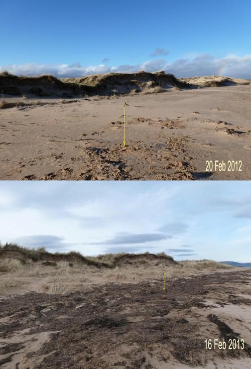
Collage of two colour photographs comparing the erosion of the Dornoch links dunes in the year Feb 2012-13. The image shown of the state on 20 Feb 2012 is from a closer viewpoint to the dunes than the lower image of 16 Feb 2013. Both images show yellow arrows marking the original GPS location at Grid ref NH 80764 87588, of the small pine tree on top of the dune (see previous image). The lower image shows that during 2012 there was some growth of grass at the foot of the dunes but, unfortunately, this reclamation was eroded by the high sea states during the storms of Dec 12 and Jan 13. The remnant seaweed from the storms can be clearly seen in the lower image.
Dimensions: jpeg file
Comments
Form Goes Here