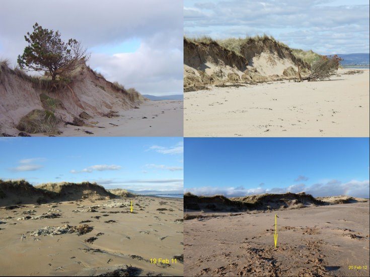
Overview of Dornoch Beach erosion 18 Feb 2009 - 20 Feb 2012
Date Added: 24 February 2012
Year: 2012
Institution Name: dnhhl
Cat No: ◀ | 2009_110_06 | ▶
Picture No: 10931
Collage of four colour photographs comparing the erosion of the Dornoch links dunes from 18 Feb 2009 to 20 Feb 2012. The upper photographs show years 2009 and 2011 and the lower pair 2011 and 2012.. The yellow arrows in the latter pair at Grid ref NH 80764 87588, the original location of the small pine tree on top of the dune. The upper branches of the Scots pine tree were sawn off and used for a beach barbeque in 2010 and until Dec 2010 the remaining stump was visible but was covered by sand by Feb 2011. The GPS location of the foot of the sand dune on 19 Feb 2011 was NH 80755 87592 and it had retreated by a further metre in 2012.
Dimensions: jpeg file
Comments
Form Goes Here