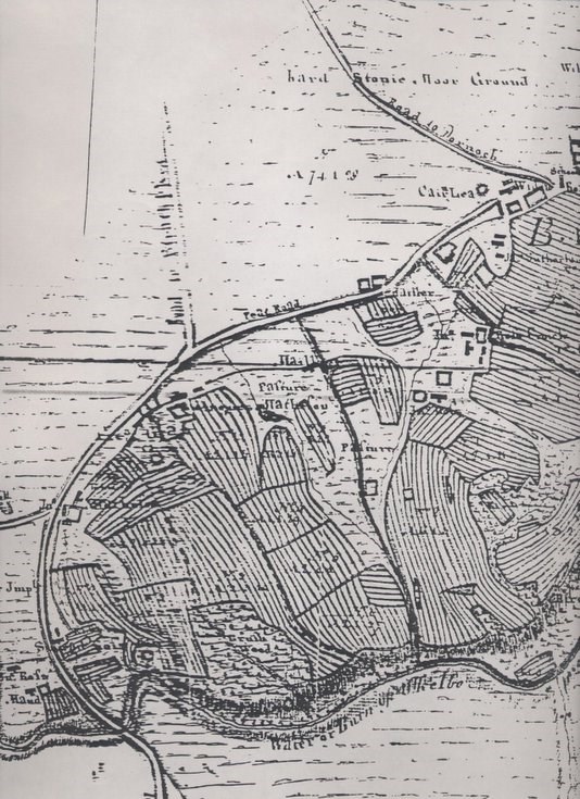
Sutherland Estate map showing Ballvraid and pasture to west
Date Added: 06 June 2011
Year: 1788
Institution Name: dnhhl
Cat No: ◀ | 2011_045 | ▶
Picture No: 10202
Copy of a large scale Sutherland Estate map 1788, with number VII, showing the crofts in Ballvraid pre-clearance and the common hill pasture to the west.
Dimensions: A3
Comments
Form Goes Here