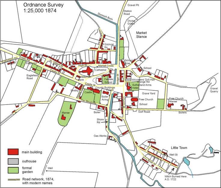
Reproduction of Ordnance Survey map of Dornoch 1874
This reproduction map shows the first detailed Government survey, carried out in 1874, of this part of Scotland and is extremely accurate. A comparison with the 1826 estate plan (2011.034.03) shows only small deviations of a few metres, indicating how accurate the Estate's surveyor was! The period between 1826 and 1874 corresponded to a great increase in the fortunes of the town due largely to investments by Sutherland Estate. Some of the significant changes were:
1835-37. Cathedral repaired and Nave rebuilt by Countess/Duchess of Sutherland
1840: The Deanery built on site of old Deanery in Castle St.
1844. New Prison built (= present 'Jail').
1844. Free Church built with adjoining School House.
1850: New Court House built.
by 1860. The Caledonian Bank and the Eagle Inn established.
1860s: Police Office established.
See also 2011.034.06 for detail of the changes 1826-1874
Dimensions: jpeg file