Dornoch Town map exhibition 18th century to 2010
Date Added: 27 May 2010
Year: 2010
Institution Name: dnhhl
Cat No: ◀ | 2010_048 | ▶
Picture No: 9054
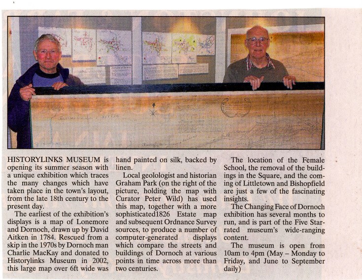
Extract from the Northern Times of publicity for the summer 2010 Historylinks Museum exhibition of the changing Dornoch Town maps from the 18th century to 2010. The accompanying colour photograph shows Museum Curator Peter Wild and exhibition compiler Graham Park holding the Aitken 1784 map which formed the starting point for the exhibition of the changing face of Dornoch.
Dimensions: A5
Comments
Form Goes Here