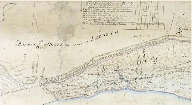
Map Lonemore of Dornoch
Date Added: 01 May 2009
Year: 1783
Institution Name: dnhhl
Cat No: ◀ | 2009_002 | ▶
Picture No: 7489
Laminated photograph of the plan of the Lonemore of Dornoch. Copy dated 1889 by Donald McLean of Survey made in 1783 by David Aitken. Covers Dornoch Bay to Skibo Bay. The map was photographed by Ewan Weatherspoon to produce a high quality image file that could be zoomified on the Historylinks Image Library (see 2001_121 picture #947).
Dimensions: Height 630 Width 1320 mm
Comments
Form Goes Here