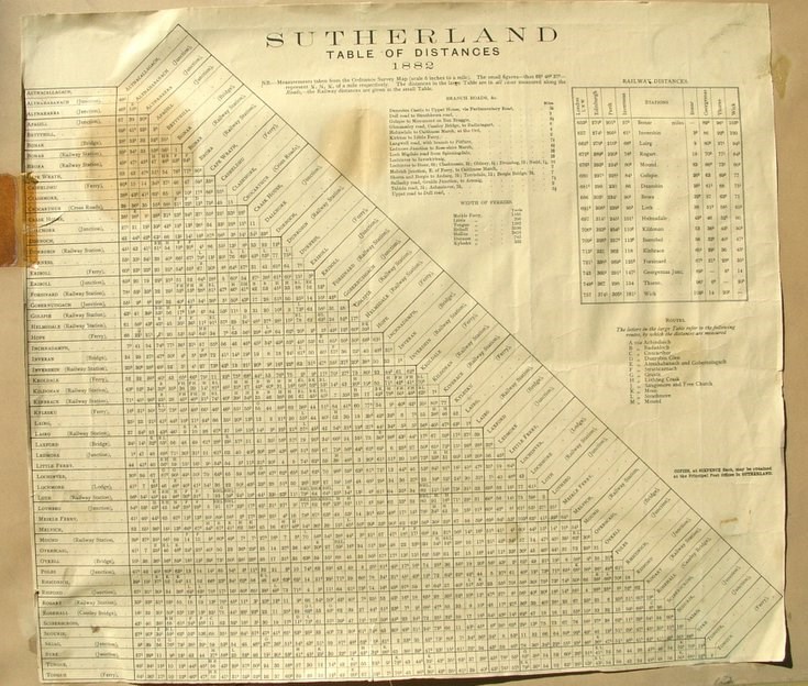
Sutherland Table of Distances 1882
Date Added: 04 November 2008
Year: 1882
Institution Name: dnhhl
Cat No: ◀ | 2008_111 | ▶
Picture No: 5969
A table mounted on card with heading Sutherland Table of Distances 1882 listing principal road junctions, railway stations and ferries with distance in miles between each other. There is separate table of Railway distances between stations and one of the width of ferry crossings. The distances in the main table are all measured from Ordnance Survey 6" map and are along roads. Table is cut off at the bottom and the source is not known but likely to have been used by Royal Mail. Salvaged from the Sheriff's Clerk's office Dornoch.
Dimensions: Length112 mm - Diameter 90 mm
Comments
Form Goes Here