Map to accompany report on Dornoch 1821 - 1831
Date Added: 04 October 2008
Year: 1840
Institution Name: dnhhl
Cat No: ◀ | 2001_393_002 | ▶
Picture No: 5285
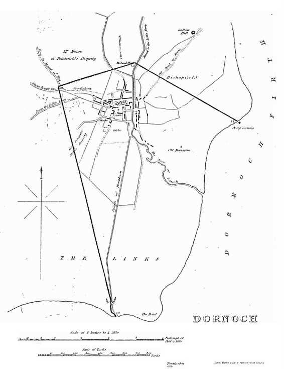
Map to accompany report on the Burgh of Dornoch, appearance, condition and population in 1821 & 1831, and proposed boundary changes, c 1832. Copy, mounted on card from book "statistical record of Scotland". Map shows suggested boundary of Burgh, extent of housing, roads etc. (see also 2001_393_001)
Dimensions: Length296mm - Width 210 mm
Comments
Form Goes Here