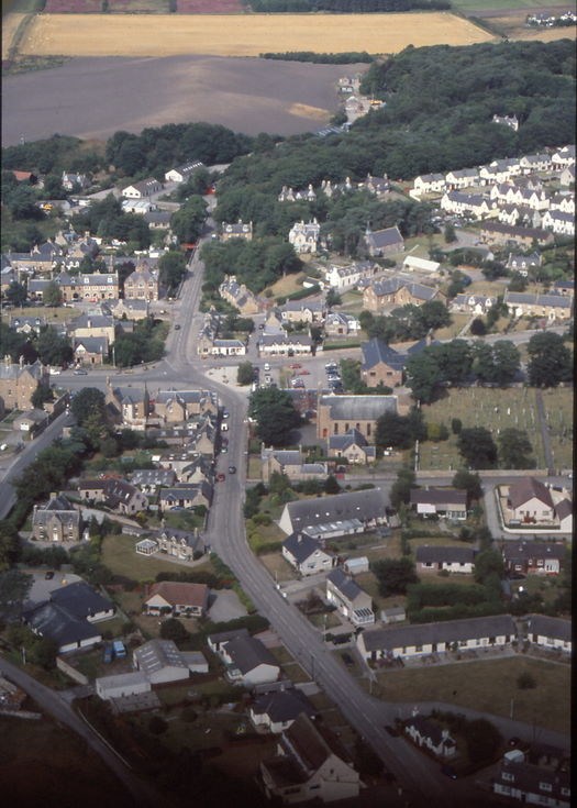
Aerial photograph of Church Street - Station Road Dornoch
Date Added: 23 September 2008
Year: 2003
Institution Name: dnhhl
Cat No: ◀ | 2004_134_07 | ▶
Picture No: 4878
Colour photograph of showing Church Street stretching from the bottom of the frame, with right and left bends to 'The Square', the central area of Dornoch. Station Road then leads north towards Embo. Dornoch Free Church is to the right of Church Street prior to its curve into 'The Square'. In a line from the eastern edge of the Free Church there is the sandstone Police Station, the 'L' shape sandstone Dornoch Community Centre (originally Dornoch School) and , St Finnbarrs Church standing before a tree line.
From a box of 23 colour 35mm slides taken by Peter Wild during a microlight flight in summer 2003.
Dimensions: Height 50mm - Width 50mm
Comments
Form Goes Here