Strathnaver settlements
Date Added: 24 April 2008
Year Range: 1980 - 2000
Institution Name: dnhhl
Cat No: ◀ | 2003_111_001 | ▶
Picture No: 363
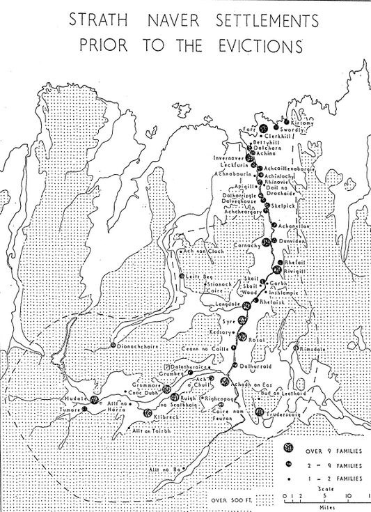
Map showing location and size of settlements in Strathnaver before the evictions. Drawn by Bob Gourlay, Highland Regional Council archaeologist. 2 copies.
Dimensions: A4 paper
Comments
Form Goes Here