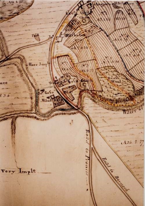
Part of Skelbo area estate map
Date Added: 24 April 2008
Year Range: 1760 - 1800
Institution Name: dnhhl
Cat No: ◀ | 2006_187 | ▶
Picture No: 2355
Colour photo of part of an estate map showing an area north west of Dornoch, possibly near Skelbo Wood. From the style, the map looks as if it is the work of surveyor David Aitken. The original from which this is taken appears to be in very good condition. Its identity and location are unknown.
Dimensions: Width 125mm - Height 185mm
Comments
Form Goes Here