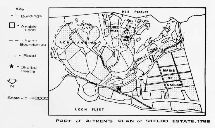
Map of part of Skelbo Estate 1788
Date Added: 24 April 2008
Year Range: 1990 - 2002
Institution Name: dnhhl
Cat No: ◀ | 2006_160_02 | ▶
Picture No: 2279
Photocopy, from a book, of a map (scale 1:13,500) of part of the Skebo Estate of 1788 with legend of symbols used. Bears inscription Fig 11.7 Part of Skelbo Estate, 1788; after the plan by David Aitken.
Dimensions: A5
Comments
Form Goes Here