Lonemore of Dornoch
Date Added: 16 June 2023
Year Range: 1783 - 1889
Institution Name: dnhhl
Cat No: ◀ | 2001_121_001 | ▶
Picture No: 15403
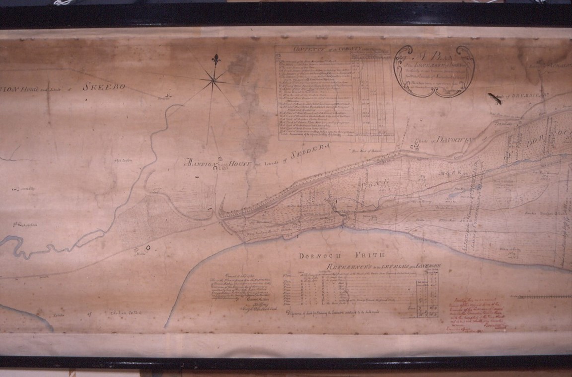
Plan of the Lonemore of Dornoch. Copy dated 1889 by Donald McLean of Survey made in 1783 by David Aitken. Covers Dornoch Bay to Skibo Bay. Drawn in black and brown ink and watercolour on silk? mounted on paper mounted on linen. Slightly torn. Donor found it in a skip in Dornoch in the 1970s.
Conservation report by SMC November 2002 - see office filing cabinet. Conservation undertaken by Fiona Butterfield February 2004. Set of 5 colour slides of complete map
For close-up views see 2001_121_002 (use left pointing arrowhead on right of Cat No) for 'Zoomify' image using +/- to zoom in and out and cursor to scan.
Dimensions: Width 2140mm - Height 830mm
Comments
Form Goes Here