Cnoc Garbh-airigh survey display
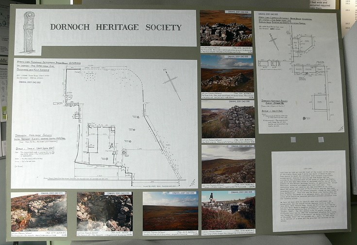
Original pencil survey map of Cnoc Garbh-airigh (Loch Laro) pre-eviction settlement. Loch Laro or Loch an Lairidh (Loch of the ruins) is the source of the Evelix River some 5 miles due north of Bonar Bridge. From source to mouth its catchment area contains significant archaeological remains of varying age from Bronze Age hut circles to the possible site of the grave of Sigurd the Mighty and on to the many many sites of abandoned crofts, one of which, members of the Dornoch Heritage Society, in particular Dr. Struan Robertson, surveyed and mapped here near Loch Laro. This particular site, not named on any map available to us, lies about 400 metres south-east of Puill Fraoich and may have been considered part of it for census purposes, though we have named it Cnoc Garbhairigh. This site and the Rhian site farther down the Evelix Valley and shown on an adjacent sheet, are typical of the sites which should be recorded and where possible preserved from the forestry plough.
We have not been able to identify when this settlement was established, but the Creich Parish Register tells us that on July 22nd, 1810 ‘Donald Ross, tenant at Pillfrich (sic) had by his wife Nelly Munro-a daughter Katherine’ and that ‘John Ross of Garvary married Catherine Ross of Pilfruich (sic) on 30th January 1849’. The 1841 census lists 32 people living at Pilfroich (sic) but by 1884 the Sutherland Valuation Roll lists the ‘House and land-Filleidhfraoich’ as being rented by ‘Heirs of Alexander Ross’ for two guineas and, sadly, by 1887 there is no mention of a house and the grazing had reverted to the estate.
Dimensions: Height 750 mm - Width 950 mm
Groups: Archaeology