NeSand dune vegetation survey of Dornoch
Date Added: 12 February 2012
Year: 1994
Institution Name: dnhhl
Cat No: ◀ | 2007_059 | ▶
Picture No: 10725
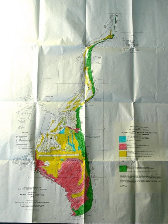
Hand-coloured map showing sand dune vegetation types and sensitivity to damage; covers area from Meikle Ferry to Embo. Part of national sand dune survey by Scottish Natural Heritage; local survey by T. Dargie, Dornoch.
Dimensions: Length1000 mm - Width 835 mm
Comments
Form Goes Here